
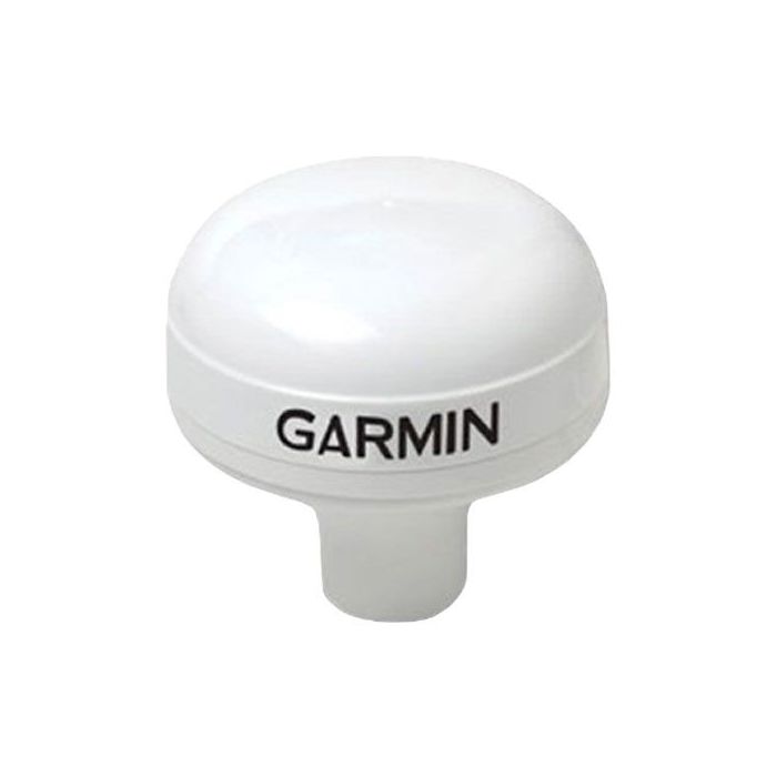
Garmin GPS 24xd HVS Marine GNSS Receiver
The highly accurate GPS 24xd HVS position receiver/antenna provides up to 10 Hz update rates for position, velocity and time data.
Features
- Provides access to GPS, Galileo, GLONASS and BeiDou satellite systems
- Accurate to <1 meter CEP, <3 meters 95%
- IPX7 waterproof sensor with pole and flush mount options
Starting At
$400.00
Stock
9
AVAILABLE
Fondriest Exclusives
- Free ground shipping
- Expedited repair and warranty service
- Lifetime technical support
- More
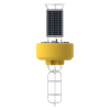
GPS 24xd HVS
The highly accurate GPS 24xd HVS position receiver/antenna provides up to 10 Hz update rates for position, velocity and time data. It offers high-sensitivity reception and enhanced position acquisition to the Garmin family of marine instruments, autopilots and multifunction displays.
Delivers Precise Location Data
This receiver is capable of tracking multiple global navigation satellite systems, including GPS, Galileo, GLONASS and BeiDou. Since more satellites are visible, it can provide more accurate fixes in challenging conditions. WAAS-capable, it can determine precise location to within <1 meter CEP, <3 meters 95%.
Observable Advantages
Compared to units with slower update rates, the GPS 24xd offers dramatic improvement when used at low speeds. Position and course information from slower units can jitter and swing considerably at speeds below 1 mph. The GPS 24xd provides a consistent and smooth heading which is especially important when trying to hit a specific waypoint or mark.
Built for Versatility
Part of the Garmin marine instrument family, the GPS 24xd HVS is built to withstand the elements. This waterproof (IPX7) sensor can be pole mounted or flush mounted. It also can be attached to the underside of many fiberglass decks for added ease of installation. In addition, it also can be configured to have 1 Hz or 5 Hz update rates to help support specific installation requirements.
- Dimensions (D x H): 3 19/32" x 1 15/16" (91.6 mm x 49.5 mm)
- Weight: 7.1 oz (201 g)
- Cable length: 30 ft (9.14 m)
- Temperature range: -22° to 176° F (-30° to 80° C)
- Case material: Fully gasketed, high-impact plastic alloy; waterproof to IPX7
- Compass-safe distance: .5" (12.7 mm)
- Power source input: 8-32V, unregulated
- Input current: 150 mA at 12 Vdc
- Position accuracy, typical marine use: < 50 cm, CEP 50%; < 1.0 meter, 88%
- GPS 24xd HVS
- Pole mount
- Surface mount
- Under deck mount
- Power/data cable
- Update rate select cable
- Documentation
Questions & Answers
Select Options
Products
0 Item Selected
Image
Part #
Description
Price
Stock
Quantity

010-02316-00
GPS 24xd HVS marine GNSS receiver with bare wires, 10m cable
$400.00
Check Availability

GPS24XD-UW
GPS 24xd HVS marine GNSS receiver with UW plug connector, 3m cable
$595.00
9 Available

GPS24XD-MC
GPS 24xd HVS marine GNSS receiver with MCIL-8-FS connector, 3m cable
$745.00
Check Availability
Accessories
0 Item Selected


Notice: At least 1 product is not available to purchase online
Related Products
In The News


