
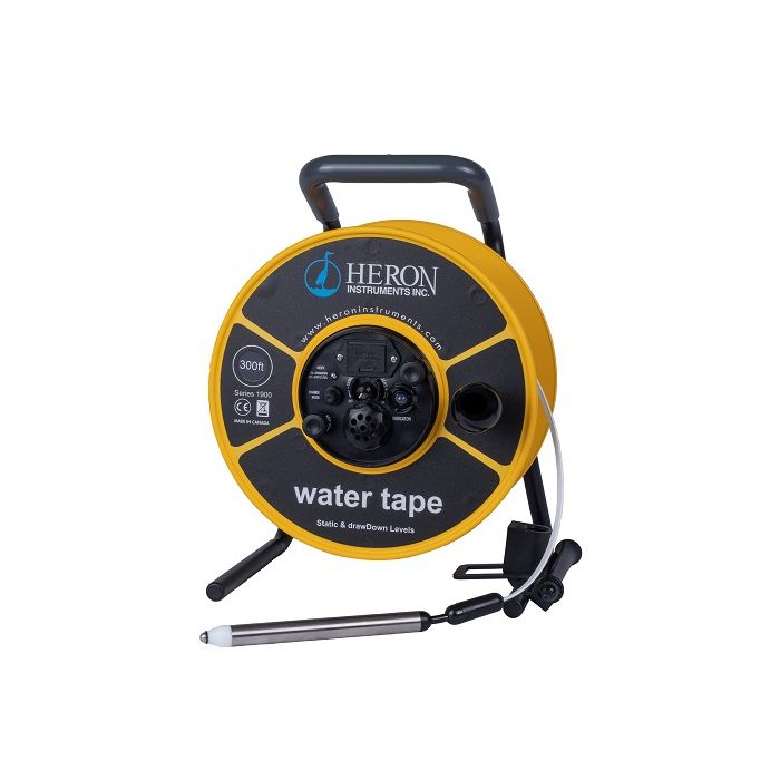
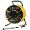
Heron water tape Water Level Meters
The Heron water tape Water Level Meters make are an ideal choice for measuring both static and drawdown levels in wells, boreholes, standpipes, and open bodies of water.
Features
- Corrosion-resistant stainless steel fittings
- Water and dust proof encapsulated electronics
- Easily changeable 9V battery
Starting At
$596.60
Stock
SEE TABLE BELOW
Fondriest Exclusives
- Free ground shipping
- Expedited repair and warranty service
- Lifetime technical support
- More
Overview
The Heron water tape, an economical water level meter, can now be used for measuring both static and drawdown levels in open bodies of water, wells, boreholes and standpipes. This low cost unit with dual function capability is ideal for every project and budget.
Design
The water tape, manufactured with the white polyethylene tape reinforced with Kevlar, is available in both metric and engineering scale. Unlike some other white tape units, the water tape comes with a fully pressure rated probe and carry bag.
- Polyethylene Tape w/ Heat Stamped Markings
- 5/8” (16mm) Water Level Probe (IP68) w/ holder
- Electronic Panel with audio and visual signals (Fully Encapsulated to IP65)
- Sensitivity dial to tune out cascading water
- Vinyl, ergonomic holding grip
- 9V Battery
- Backpack Carrying Case w/ adjustable straps, laptop & notepad pouches
Questions & Answers
Select Options
Products
0 Item Selected
Image
Part #
Description
Price
Stock
Quantity

1902-100FT
water tape water level meter with 5/8" probe & imperial increments, 100'
$596.60
Drop Ships From
Manufacturer

1902-30M
water tape water level meter with 5/8" probe & metric increments, 30m
$596.60
Drop Ships From
Manufacturer

1902-200FT
water tape water level meter with 5/8" probe & imperial increments, 200'
$697.30
Drop Ships From
Manufacturer

1902-60M
water tape water level meter with 5/8" probe & metric increments, 60m
$697.30
1 Available

1902-300FT
water tape water level meter with 5/8" probe & imperial increments, 300'
$806.55
Drop Ships From
Manufacturer

1902-100M
water tape water level meter with 5/8" probe & metric increments, 100m
$806.55
Drop Ships From
Manufacturer

1902-500FT
water tape water level meter with 5/8" probe & imperial increments, 500'
$1,007.00
Drop Ships From
Manufacturer

1902-150M
water tape water level meter with 5/8" probe & metric increments, 150m
$1,007.00
Drop Ships From
Manufacturer

1902-750FT
water tape water level meter with 5/8" probe & imperial increments, 750'
$1,463.00
1 Available

1902-200M
water tape water level meter with 5/8" probe & metric increments, 200m
$1,463.00
Drop Ships From
Manufacturer

1902-1000FT
water tape water level meter with 5/8" probe & imperial increments, 1000'
$1,818.30
1 Available

1902-300M
water tape water level meter with 5/8" probe & metric increments, 300m
$1,818.30
Drop Ships From
Manufacturer
Notice: At least 1 product is not available to purchase online
Related Products
In The News


