
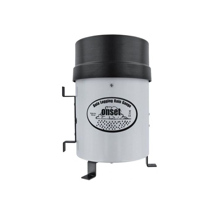
HOBO Data Logging Rain Gauge
The Onset HOBO Data Logging Rain Gauge is battery-powered and includes a HOBO Pendant Event data logger with a tipping-bucket rain gauge.
Features
- Time and date stamp is stored for each tip for determining rainfall rates and duration
- Compatible with HOBOware and HOBOware Pro software for logger setup, graphing and analysis
- Also records temperature when used with an optional solar radiation shield
Starting At
$555.00
Stock
Check
Availability
Fondriest Exclusives
- Free ground shipping
- Expedited repair and warranty service
- Lifetime technical support
- More
Overview
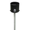
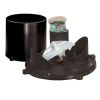
Record up to 160 in. of rainfall at rates up to 12.7 cm (5 in.) per hour. The Data Logging Rain Gauge system is battery-powered and includes a HOBO Pendant Event data logger with a tipping-bucket rain gauge. Easily collect rainfall, time, and duration data, as well as temperature, when used with an optional solar radiation shield (RS1 Solar Radiation Shield, or M-RSA). A base station or shuttle is required.
Rain Gauge
Maximum rainfall rate: 12.7 cm (5 in.) per hour
Calibration accuracy: ±1.0% (up to 1 in./hour for the RG3 or 20 mm/hour for the RG3-M)
Resolution: 0.01 in. (RG3) or 0.2 mm (RG3-M)
Calibration: Requires annual calibration: can be field calibrated or returned to the factory for re-calibration
Operating temperature range: 0° to +50°C (+32° to +122°F)
Storage temperature range: -20° to +70°C (-4° to +158°F)
Environmental rating: Weatherproof
Housing: 15.24cm (6-in.) aluminum bucket
Tipping bucket mechanism: Stainless steel shaft with brass bearings
Dimensions: 25.72 cm height x 15.24 cm diameter (10.125 x 6 in.); 15.39 cm (6.06 in.) receiving orifice
Weight: 1.2 Kg (2.5 lbs)
Part numbers: RG3 (0.01 in. per tip) ; RG3-M (0.2 mm per tip)
Logger
Time stamp: Resolution 1.0 second
Time accuracy: ± 1 minute per month at 25°C (77°F), see Plot B on page 10.
Operating range: -20° to 70°C (-4° to 158°F)
Environmental rating (for logger used outside of rain gauge): Tested to NEMA 6 and IP67; suitable for deployment outdoors
NIST traceable certification: Available for temperature only at additional charge; temperature range -20° to 70°C (-4° to 158°F)
Battery: CR-2032 3V lithium battery; 1 year typical use
Memory: 64K bytes – 16K to 23K tips when recording rain only; 25K to 30K data points when recording rain and temperature
Materials: Polypropylene case; stainless steel screws; Buna-N o-ring; PVC cable insulation
Temperature Measurement
Measurement range: -20° to 70°C (-4° to 158°F)
Accuracy: ± 0.47°C at 25°C (± 0.85°F at 77°F). A solar radiation shield is required for accurate temperature measurements in sunlight.
Resolution: 0.10°C at 25°C (0.18°F at 77°F), see Plot A on page 10.
Drift: Less than 0.1°C/year (0.2°F/year)
Response time: Airflow of 1 m/s (2.2 mph): 10 minutes, typical to 90%
- Tipping-bucket rainfall collector
- HOBO Pendant Event Logger
- Mounting accessories: two hose clamps, three screws
Questions & Answers
Select Options
Products
0 Item Selected
Image
Part #
Description
Price
Stock
Quantity

RG3
HOBO data logging rain gauge, 0.01" per tip
$555.00
Check Availability
RG3-M
HOBO data logging rain gauge, 0.2mm per tip
$555.00
Check Availability
Accessories
0 Item Selected


Notice: At least 1 product is not available to purchase online
Related Products
In The News


