
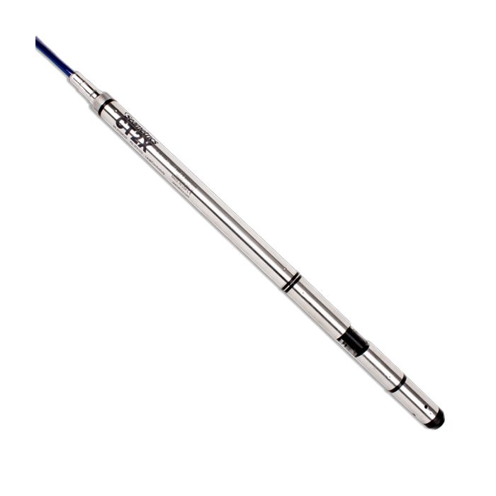
Seametrics CT2X Conductivity Loggers
The Seametrics CT2X is a conductivity and temperature sensor with built-in data logging and optional water level sensor.
Features
- Measures conductivity, temperature, and water level (optional)
- Internal data logger for 349,000 records
- Optional internal AA batteries operate for ~1 year at 15-minute log interval
Starting At
$1,908.00
Stock
1
AVAILABLE
Fondriest Exclusives
- Free ground shipping
- Expedited repair and warranty service
- Lifetime technical support
- More
Overview
The Seametrics CT2X is a conductivity and temperature sensor with built-in data logging. Incorporating a 4-pole epoxy and graphite electrode cell, it is extremely durable and resistant to data interferences — making it excellent for use in rugged field conditions.
Extensive Control
The CT2X also comes with Seametrics' powerful, easy-to-use Aqua4Plus and Aqua4Plus Lite software, affording the user extensive control, including real-time monitoring, flexible programming, and versatile data display options.
Benefits
- Measures conductivity, total dissolved solids, and temperature
- Ranges from 10 microsiemens/cm to 100,000 microsiemens/cm
- Pressure and level option available
- In-field calibration utilities
- Narrow 0.75″ diameter, 12.5″ or 16″ length (depending on version)
- Linear and nLFn temperature compensation
- Up to 349,000 records in non-volatile memory
- 316 stainless steel, fluoropolymer, and PTFE construction (titanium optional)
- Digital industry standard RS485 interface
- Available with a variety of cable options—including polyethylene, polyurethane, and FEP Teflon
- Modbus and SDI-12 protocols available
- Easy export to spreadsheets and databases
Questions & Answers
Select Options
Products
0 Item Selected
Image
Part #
Description
Price
Stock
Quantity

2F21510
CT2X conductivity & temperature logger with stainless steel housing, includes cableless top cap
$1,908.00
Check Availability

2F21552
CT2X non-vented water level, conductivity & temperature logger with stainless steel housing, 30 PSIA range, includes cableless top cap
$2,390.00
Check Availability

2F21554
CT2X non-vented water level, conductivity & temperature logger with stainless steel housing, 50 PSIA range, includes cableless top cap
$2,390.00
Check Availability

2F21556
CT2X non-vented water level, conductivity & temperature logger with stainless steel housing, 100 PSIA range, includes cableless top cap
$2,390.00
Check Availability

2F21558
CT2X non-vented water level, conductivity & temperature logger with stainless steel housing, 300 PSIA range, includes cableless top cap
$2,390.00
Check Availability

2F22510
CT2X conductivity & temperature logger with titanium housing, includes cableless top cap
$2,279.00
Check Availability

2F22552
CT2X non-vented water level, conductivity & temperature logger with titanium housing, 30 PSIA range, includes cableless top cap
$2,734.00
Check Availability

2F22554
CT2X non-vented water level, conductivity & temperature logger with titanium housing, 50 PSIA range, includes cableless top cap
$2,734.00
Check Availability

2F22556
CT2X non-vented water level, conductivity & temperature logger with titanium housing, 100 PSIA range, includes cableless top cap
$2,734.00
Check Availability

2F22558
CT2X non-vented water level, conductivity & temperature logger with titanium housing, 300 PSIA range, includes cableless top cap
$2,734.00
Check Availability

2F31510
CT2X conductivity & temperature logger with stainless steel housing, requires cable
$2,194.00
Check Availability

2F31524
CT2X vented water level, conductivity & temperature logger with stainless steel housing, 5 PSIG range, requires cable
$2,650.00
Check Availability

2F31526
CT2X vented water level, conductivity & temperature logger with stainless steel housing, 15 PSIG range, requires cable
$2,650.00
Check Availability

2F31528
CT2X vented water level, conductivity & temperature logger with stainless steel housing, 30 PSIG range, requires cable
$2,650.00
Check Availability

2F31530
CT2X vented water level, conductivity & temperature logger with stainless steel housing, 50 PSIG range, requires cable
$2,650.00
Check Availability

2F31532
CT2X vented water level, conductivity & temperature logger with stainless steel housing, 100 PSIG range, requires cable
$2,650.00
Check Availability

2F31534
CT2X vented water level, conductivity & temperature logger with stainless steel housing, 300 PSIG range, requires cable
$2,650.00
Check Availability

2F31552
CT2X non-vented water level, conductivity & temperature logger with stainless steel housing, 30 PSIA range, requires cable
$2,650.00
Check Availability

2F31554
CT2X non-vented water level, conductivity & temperature logger with stainless steel housing, 50 PSIA range, requires cable
$2,650.00
Check Availability

2F31556
CT2X non-vented water level, conductivity & temperature logger with stainless steel housing, 100 PSIA range, requires cable
$2,650.00
Check Availability

2F31558
CT2X non-vented water level, conductivity & temperature logger with stainless steel housing, 300 PSIA range, requires cable
$2,650.00
Check Availability

2F32510
CT2X conductivity & temperature logger with titanium housing, requires cable
$2,650.00
Check Availability

2F32524
CT2X vented water level, conductivity & temperature logger with titanium housing, 5 PSIG range, requires cable
$3,111.00
Check Availability

2F32526
CT2X vented water level, conductivity & temperature logger with titanium housing, 15 PSIG range, requires cable
$3,111.00
Check Availability

2F32528
CT2X vented water level, conductivity & temperature logger with titanium housing, 30 PSIG range, requires cable
$3,111.00
Check Availability

2F32530
CT2X vented water level, conductivity & temperature logger with titanium housing, 50 PSIG range, requires cable
$3,111.00
Check Availability

2F32532
CT2X vented water level, conductivity & temperature logger with titanium housing, 100 PSIG range, requires cable
$3,111.00
Check Availability

2F32534
CT2X vented water level, conductivity & temperature logger with titanium housing, 300 PSIG range, requires cable
$3,111.00
Check Availability

2F32552
CT2X non-vented water level, conductivity & temperature logger with titanium housing, 30 PSIA range, requires cable
$3,111.00
Check Availability

2F32554
CT2X non-vented water level, conductivity & temperature logger with titanium housing, 50 PSIA range, requires cable
$3,111.00
Check Availability

2F32556
CT2X non-vented water level, conductivity & temperature logger with titanium housing, 100 PSIA range, requires cable
$3,111.00
Check Availability

2F32558
CT2X non-vented water level, conductivity & temperature logger with titanium housing, 300 PSIA range, requires cable
$3,111.00
Check Availability

2F41510
CT2X conductivity & temperature logger with stainless steel housing, requires cable & external power
$2,045.00
Check Availability

2F41524
CT2X vented water level, conductivity & temperature logger with stainless steel housing, 5 PSIG range, requires cable & external power
$2,501.00
1 Available

2F41526
CT2X vented water level, conductivity & temperature logger with stainless steel housing, 15 PSIG range, requires cable & external power
$2,501.00
Check Availability

2F41528
CT2X vented water level, conductivity & temperature logger with stainless steel housing, 30 PSIG range, requires cable & external power
$2,501.00
Check Availability

2F41530
CT2X vented water level, conductivity & temperature logger with stainless steel housing, 50 PSIG range, requires cable & external power
$2,501.00
Check Availability

2F41532
CT2X vented water level, conductivity & temperature logger with stainless steel housing, 100 PSIG range, requires cable & external power
$2,501.00
Check Availability

2F41534
CT2X vented water level, conductivity & temperature logger with stainless steel housing, 300 PSIG range, requires cable & external power
$2,501.00
Check Availability

2F41552
CT2X non-vented water level, conductivity & temperature logger with stainless steel housing, 30 PSIA range, requires cable & external power
$2,501.00
Check Availability

2F41554
CT2X non-vented water level, conductivity & temperature logger with stainless steel housing, 50 PSIA range, requires cable & external power
$2,501.00
Check Availability

2F41556
CT2X non-vented water level, conductivity & temperature logger with stainless steel housing, 100 PSIA range, requires cable & external power
$2,501.00
Check Availability

2F41558
CT2X non-vented water level, conductivity & temperature logger with stainless steel housing, 300 PSIA range, requires cable & external power
$2,501.00
Check Availability

2F42510
CT2X conductivity & temperature logger with titanium housing, requires cable & external power
$2,371.00
Check Availability

2F42524
CT2X vented water level, conductivity & temperature logger with titanium housing, 5 PSIG range, requires cable & external power
$2,815.00
Check Availability

2F42526
CT2X vented water level, conductivity & temperature logger with titanium housing, 15 PSIG range, requires cable & external power
$2,815.00
Check Availability

2F42528
CT2X vented water level, conductivity & temperature logger with titanium housing, 30 PSIG range, requires cable & external power
$2,815.00
Check Availability

2F42530
CT2X vented water level, conductivity & temperature logger with titanium housing, 50 PSIG range, requires cable & external power
$2,815.00
Check Availability

2F42532
CT2X vented water level, conductivity & temperature logger with titanium housing, 100 PSIG range, requires cable & external power
$2,815.00
Check Availability

2F42534
CT2X vented water level, conductivity & temperature logger with titanium housing, 300 PSIG range, requires cable & external power
$2,815.00
Check Availability

2F42552
CT2X non-vented water level, conductivity & temperature logger with titanium housing, 30 PSIA range, requires cable & external power
$2,815.00
Check Availability

2F42554
CT2X non-vented water level, conductivity & temperature logger with titanium housing, 50 PSIA range, requires cable & external power
$2,815.00
Check Availability

2F42556
CT2X non-vented water level, conductivity & temperature logger with titanium housing, 100 PSIA range, requires cable & external power
$2,815.00
Check Availability

2F42558
CT2X non-vented water level, conductivity & temperature logger with titanium housing, 300 PSIA range, requires cable & external power
$2,815.00
Check Availability
Accessories
0 Item Selected


Notice: At least 1 product is not available to purchase online
In The News


