
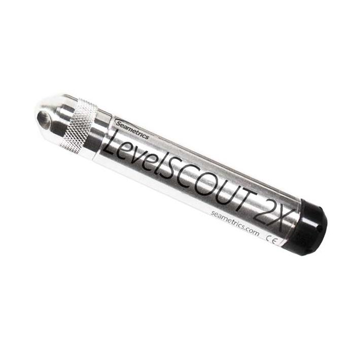
Seametrics LevelSCOUT 2X Water Level Loggers
The Seametrics LevelSCOUT 2X is a highly accurate water level and temperature sensor with integrated data logger and battery designed for unattended deployments.
Features
- Increased memory to 100,000 records
- Integrated SDI-12 or Modbus RTU RS485 output
- 5-year battery life with user-replaceable batteries
Starting At
$662.00
Stock
SEE TABLE BELOW
Fondriest Exclusives
- Free ground shipping
- Expedited repair and warranty service
- Lifetime technical support
- More
Overview
The Seametrics LevelSCOUT 2X Smart Sensor is an integrated datalogger and level/temperature sensor and is ideal for site assessments, tidal studies, environmental monitoring, surface water discharge measurement, and aquifer level monitoring, as well as aquifer storage and recovery. This sensor networks with all of the Seametrics Smart Sensor family.
Data Storage
This industry standard digital RS485 interface device records up to 100,000 records of level, temperature, and time data, operates with low power, and features easy-to-use software with powerful features. Constructed with 316 stainless steel, acetal, and fluoropolymer, this sensor provides highaccuracy readings in rugged and corrosive field conditions. The LevelSCOUT 2X with Seametrics’ Aqua4Plus 2.0 software or a different software/logging equipment can be used to read measurements via RS485 and/or SDI-12.
Design
The LevelSCOUT 2X is an absolute sensor, requiring no vent tubes, desiccant, or bellows. It can be paired with a BaroSCOUT 2X barometric sensor and used with the Aqua4Plus 2.0 Barometric Compensation Utility to adjust the LevelSCOUT 2X readings for current atmospheric pressure. A replaceable 2/3 AA 3.6v lithium battery powers the LevelSCOUT 2X. The unit is programmed using our easy-to-use control software. Once programmed the unit will measure and collect data at the time interval set.
Questions & Answers
Select Options
Products
0 Item Selected
Image
Part #
Description
Price
Stock
Quantity

2R21112
LevelSCOUT 2X water level & temperature logger with stainless steel housing & cableless top cap, 30 PSIA range
$662.00
4 Available

2R21114
LevelSCOUT 2X water level & temperature logger with stainless steel housing & cableless top cap, 50 PSIA range
$662.00
2 Available

2R21116
LevelSCOUT 2X water level & temperature logger with stainless steel housing & cableless top cap, 100 PSIA range
$662.00
Check Availability

2R21118
LevelSCOUT 2X water level & temperature logger with stainless steel housing & cableless top cap, 300 PSIA range
$662.00
1 Available

2R21222
LevelSCOUT 2X water level & temperature logger with stainless steel housing & cabled connector termination, 30 PSIA range, requires cable
$662.00
Check Availability

2R21224
LevelSCOUT 2X water level & temperature logger with stainless steel housing & cabled connector termination, 50 PSIA range, requires cable
$662.00
Check Availability

2R21226
LevelSCOUT 2X water level & temperature logger with stainless steel housing & cabled connector termination, 100 PSIA range, requires cable
$662.00
Check Availability

2R21228
LevelSCOUT 2X water level & temperature logger with stainless steel housing & cabled connector termination, 300 PSIA range, requires cable
$662.00
Check Availability

2R21232
LevelSCOUT 2X water level & temperature logger with stainless steel housing & cabled bare wire termination, 30 PSIA range, requires cable
$662.00
Check Availability

2R21234
LevelSCOUT 2X water level & temperature logger with stainless steel housing & cabled bare wire termination, 50 PSIA range, requires cable
$662.00
Check Availability

2R21236
LevelSCOUT 2X water level & temperature logger with stainless steel housing & cabled bare wire termination, 100 PSIA range, requires cable
$662.00
Check Availability

2R21238
LevelSCOUT 2X water level & temperature logger with stainless steel housing & cabled bare wire termination, 300 PSIA range, requires cable
$662.00
Check Availability
Accessories
0 Item Selected


Notice: At least 1 product is not available to purchase online
In The News


