
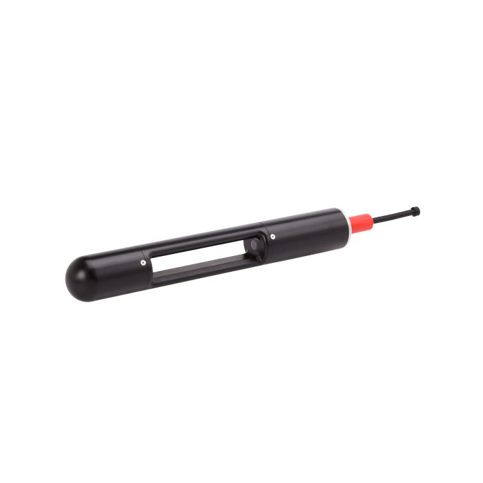
Sequoia LISST-Tau Transmissometer
LISST-Tau is a high-precision transmissometer for underwater vehicles, profiling packages, CTDs, and remote monitoring systems.
Features
- Measures optical transmission and beam attenuation
- RS-232 and analog real-time outputs
- Integrated temperature compensation & ambient light rejection
Your Price
Call
Stock
Check
Availability
Fondriest Exclusives
- Expedited repair and warranty service
- Lifetime technical support
- More
Overview
LISST-Tau is a high-precision transmissometer for underwater vehicles, profiling packages, CTDs, and other systems. With high-quality optics and a carefully selected LED source, it transmits a collimated beam through the water, and precisely measures the light transmitted through its 15 cm path. Light modulation with synchronous detection rejects ambient light, while oversampling and averaging yield better than 16-bit resolution. LISST-Tau’s digital controller applies calibration coefficients, corrects for temperature effects, and transmits data from both digital and analog outputs. Included software provides real-time display of data, and functions for checking and updating pure-water calibrations. An optional flow-through chamber simplifies calibrations and experiments. LISST-Tau advances the state of the art for in-situ transmissometers.
Remote Monitoring
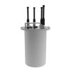
The LISST-Tau transmissometer offers a plug-and-play interface to the NexSens X3 data loggers and telemetry systems. The X3 is available for pole-mount/buoy-based deployments with solar charging or connected to the X3-SUB submersible data logger with alkaline battery pack for subsurface deployments.
Parameters Measured
- Optical transmission
- Beam attenuation
Operating Ranges and Stability
- Operational temperature range: -3 °C to 40 °C
- Storage temperature range: -20 °C to 60 °C
- Beam attenuation range: ~0 m-1 to 30 m-1
- Linearity (concentration): >99 %
- Short-term stability (typical standard deviation over 1 minute)
- Transmission: 0.003 %FS (Green) / 0.005% (Red)
- Beam attenuation: 0.0002 m-1 (Green) / 0.0004 m-1 (Red)
- Long-term stability (6 hr test)
- Transmission: ~0.003 %FS/hr
- Beam attenuation: ~0.0002 m-1∙hr-1
Technology
- Optical path length: 15 cm
- Source wavelength: ~532 nm (Green) or ~650 nm (Red) LED
- Source spectral bandwidth: <10 nm FWHM
- Acceptance angle (half angle, in water): 1.0 °
- Optical transmission @ 16-bit resolution
Mechanical and Electrical
- Dimensions [Ø x L]: 5.1 cm x 40.6 cm (2.00″ x 16″)
- Weight [air / seawater]: 1.140 kg / 0.585 kg (2.5 lbs / 1.3 lbs)
- Depth rating: 2,000 m
- Sampling rate: 1 Hz
- External power input: 7 VDC to 25 VDC
- Current drain @ 12V: 42 mA average during sampling
- Connector: SubConn MCBH6M
- LISST-Tau transmissometer
- LISST-Tau 2-meter integrated communication and external power USB cable
- Windows software for real-time display of data, and functions for checking and updating pure-water calibrations
- Shipping case
Questions & Answers
Select Options
Products
0 Item Selected
Image
Part #
Description
Price
Stock
Quantity

SEQ-FP-LTAU-532NM
LISST-Tau high-precision transmissometer, 532 nm (green) LED source
Request Quote
Check Availability

SEQ-FP-LTAU-650NM
LISST-Tau high-precision transmissometer, 650 nm (red) LED source
Request Quote
Check Availability
Accessories
0 Item Selected


Notice: At least 1 product is not available to purchase online
Related Products
In The News


