
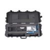
SonTek FlowTracker2 ADV Probes
The Sontek FlowTracker2 ADV probe can be used in the field with the handheld display, or it can be used in the lab with direct PC connection.
Features
- Versatile probe can be used in the lab or field
- Optional integrated pressure sensor for depth data
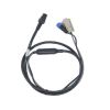
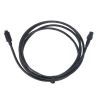
- Available extension cables in 1.5m, 3.5m, and 8.5m lengths
Your Price
Call
Stock
1
AVAILABLE
Fondriest Exclusives
- Expedited repair and warranty service
- Lifetime technical support
- More
Overview
The Sontek FlowTracker2 ADV probe can be used in the field with the handheld display, or it can be used in the lab with direct PC connection. The ADV’s acoustic probe and processing electronics are housed in one small, lightweight, easily maneuverable unit, and the acoustic head has an optional, integrated pressure (depth) sensor.
Mechanics
Depth data are even correctable for dynamic pressure (Bernoulli) and altitude effects using SonTek’s patent-pending method. Setup of the probe and PC software is simple and mistake-proof. Just connect the cables between the probe and a laboratory PC or laptop, check a few settings, and press the “Start Logging” button. Data are output directly to a .CSV file that is immediately ready for use in the project, model, or database as required.
Probe Specifications
| Velocity Range | ±0.001 to 4.0 m/s (0.003 to 13 ft/s) |
| Velocity Resolution | 0.0001 m/s (0.0003 ft/s) |
| Velocity Accuracy | +/1% of measured velocity, +/- 0.25cm/s |
| Acoustic Frequency | 10.0 MHz |
| Sampling Volume Location | 10 cm (3.93 in) from the center transducer |
| Minimum Depth | 0.02 m (0.79 in) |
| Depth Measurement Range | 0 to 10m (0 to 32.81ft) |
| Depth Measurement Resolution | 0.001m (0.003ft) |
| Depth Sensor Accuracy | +/- 0.1% of FS (temperature compensated over full operating range) |
| +/- 0.05% Static (steady-state at 25°C) | |
| Additionally compensated for real-time water velocity, temperature, salinity, and altitude. |
|
| Temperature Sensor | Resolution: 0.01° C, Accuracy: 0.1° C |
| Tilt Sensor | Resolution: 0.001°, Accuracy: 1.0° |
| Communication Protocol | RS-232 |
| Operating/Storage Temperature | -20° C to 50° C (-4° F to 122° F) |
| Probe Head Dimensions | (L)13.3 cm (5.22 in) (W) 6.1 cm (2.39 in) (H) 2.3 cm (0.90 in) |
| Standard Cable Length | 1.5 m (4.92 ft) |
| Weight in Air | 0.90 kg (1.98 lbs) |
| Weight in Water | 0.30 kg (0.66 lbs) |
Questions & Answers
Select Options
Products
0 Item Selected
Image
Part #
Description
Price
Stock
Quantity
FT2-2D
FlowTracker2 probe assembly with 2D side-looking 10 MHz ADV probe, 1.5m cable
Request Quote
1 Available
FT2-2D3D
FlowTracker2 probe assembly with 2D/3D side-looking 10 MHz ADV probe, 1.5m cable
Request Quote
Check Availability
FT2-2D-P
FlowTracker2 probe assembly with integrated depth sensor & 2D side-looking 10 MHz ADV probe, 1.5m cable
Request Quote
Check Availability
FT2-2D3D-P
FlowTracker2 probe assembly with integrated depth sensor & 2D/3D side-looking 10 MHz ADV probe, 1.5m cable
Request Quote
Check Availability
Accessories
0 Item Selected


Notice: At least 1 product is not available to purchase online
Related Products
In The News


