
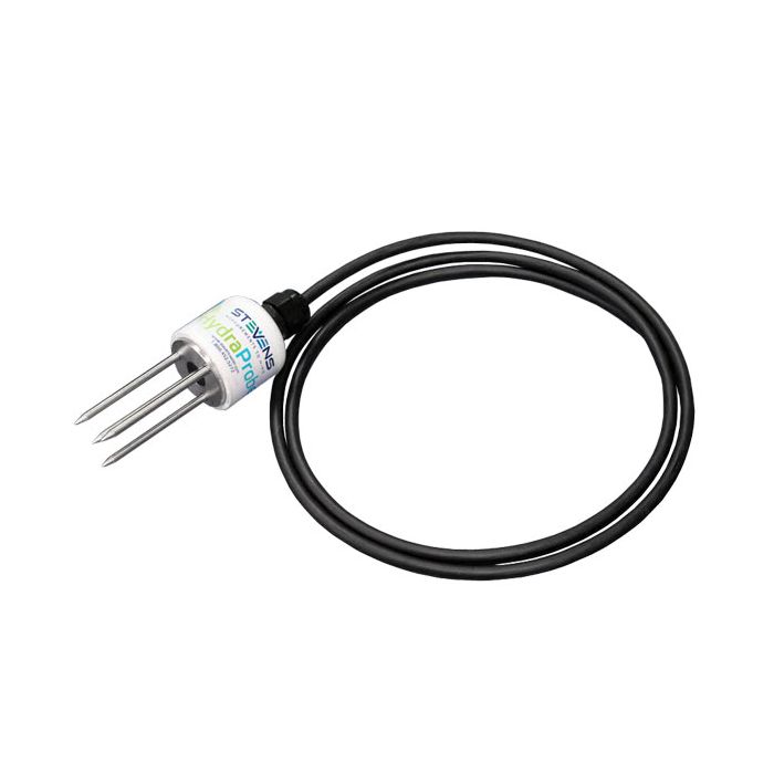
Stevens HydraProbe Soil Moisture Sensors
The Stevens HydraProbe is a sensor that simultaneously measures soil moisture, salinity, and temperature using a unique patented design.
Features
- Instantaneous sensor response with no calibration requirements
- Compact, rugged, zero-maintenance design for long-term deployments
- Easy integration with NexSens data logging & telemetry products
Starting At
$545.00
Stock
4
AVAILABLE
Fondriest Exclusives
- Free ground shipping
- Expedited repair and warranty service
- Lifetime technical support
- More
Overview
The Stevens Hydraprobe measures 21 different soil parameters simultaneously. The HydraProbe instantly calculates soil moisture, electrical conductivity, salinity, and temperature and supplies raw voltages and complex permittivity for research applications. A compact, rugged design with potted internal components makes the HydraProbe easy to deploy and leave in the soil for years without maintenance.
Electrical Response Parameters
The Stevens HydraProbe design is unique compared to other soil moisture probes because the electrical response of soils can be specified by two parameters - the dielectric constant and the conductivity. The dielectric constant is most indicative of water content, while the conductivity is strongly dependent on soil salinity. Unlike other capacitance-type sensors, the HydraProbe measures both of these components simultaneously. The high-frequency electrical measurements indicating the capacitive and conductive properties of soil are then directly related to the soil's moisture and salinity content, while a thermistor determines soil temperature.
Remote Capabilities
The HydraProbe soil moisture sensor includes SDI-12 or RS-485 outputs for interfacing with external data loggers such as the NexSens X3. Sensor cables can be factory-connected with NexSens UW plug connectors for integration to an X3 data logger sensor port. Data retrieval options using the X3 include direct-connect, Wi-Fi, cellular, and Iridium satellite telemetry.
Questions & Answers
Select Options
Products
0 Item Selected
Image
Part #
Description
Price
Stock
Quantity

56012-02
HydraProbe PROFESSIONAL soil moisture, temperature, & salinity sensor with SDI-12 interface, 25' cable
$545.00
4 Available

56485-02
HydraProbe PROFESSIONAL soil moisture, temperature, & salinity sensor with RS485 interface, 25' cable
$545.00
Check Availability

56012-04
HydraProbe PROFESSIONAL soil moisture, temperature, & salinity sensor with SDI-12 interface, 50' cable
$595.00
Check Availability

56485-04
HydraProbe PROFESSIONAL soil moisture, temperature, & salinity sensor with RS485 interface, 50' cable
$595.00
Check Availability

56012-06
HydraProbe PROFESSIONAL soil moisture, temperature, & salinity sensor with SDI-12 interface, 100' cable
$695.00
Check Availability

56485-06
HydraProbe PROFESSIONAL soil moisture, temperature, & salinity sensor with RS485 interface, 100' cable
$695.00
Check Availability
Accessories
0 Item Selected


Notice: At least 1 product is not available to purchase online
Related Products
In The News


