
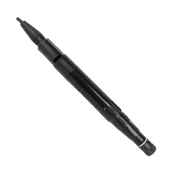
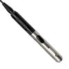
YSI ODO/CT Probe & Cable Assemblies
The YSI ODO/CT probe and cable assembly features integral optical dissolved oxygen, conductivity, and temperature sensors and is available in lengths up to 100 meters.
Features
- One–cable design for easy, multiparameter measurements in the field and at deep depths
- Rugged probe and cable designed for field work with 2-year warranty
- Automatically compensates DO mg/L measurements for salinity; no need to enter salinity compensation values
Starting At
$1,457.30
Stock
Check
Availability
Fondriest Exclusives
- Free ground shipping
- Expedited repair and warranty service
- Lifetime technical support
- More
Overview
The YSI ODO/CT probe is the first expansion of the ProDIGITAL system. The ODO/CT probe and cable assembly features integral (i.e. built-in) optical dissolved oxygen, conductivity, and temperature sensors and is available in lengths up to 100 meters. Instrument setup is quick and easy with the integral sensors, which eliminates the need to install sensors before use and digital technology allows the handheld to automatically recognize connected sensors.
Applications
- Estuary
- Wetland
- Coastal
- Aquaculture
- Or any application requiring accurate, real-time salinity-compensated DO measurements
Benefits
The YSI ODO/CT has all the advantages of optical dissolved oxygen technology with higher accuracy, less maintenance, no stirring required for accurate measurements, holds calibration longer than membrane-covered sensors and is not susceptible to interferences from other gases.
Questions & Answers
Select Options
Products
0 Item Selected
Image
Part #
Description
Price
Stock
Quantity

627150-1
ODO/CT cable assembly with optical DO, conductivity & temperature sensors, 1m
$1,457.30
Check Availability

627150-4
ODO/CT cable assembly with optical DO, conductivity & temperature sensors, 4m
$1,457.30
Check Availability

627150-10
ODO/CT cable assembly with optical DO, conductivity & temperature sensors, 10m
$1,645.40
Check Availability

627150-20
ODO/CT cable assembly with optical DO, conductivity & temperature sensors, 20m
$1,677.70
Check Availability

627150-30
ODO/CT cable assembly with optical DO, conductivity & temperature sensors, 30m
$1,710.00
Check Availability

627150-50
ODO/CT cable assembly with optical DO, conductivity & temperature sensors, 50m
$1,797.40
Check Availability

627150-100
ODO/CT cable assembly with optical DO, conductivity & temperature sensors, 100m
$2,011.15
Check Availability
Accessories
0 Item Selected


Notice: At least 1 product is not available to purchase online
Related Products
In The News


