
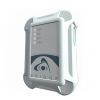
Eos Arrow Gold RTK GNSS Receivers
The Arrow Gold is the first high-accuracy iOS, Android and Windows Bluetooth GNSS receiver to implement all four global constellations, multi-frequency, and satellite-based RTK augmentation.
Features
- Supports GPS, GLONASS, Galileo & BeiDou
- 100% Android, iOS, Windows compatible
- 1cm RTK real-time accuracy
Starting At
$7,995.00
Stock
1
AVAILABLE
Fondriest Exclusives
- Free ground shipping
- Expedited repair and warranty service
- Lifetime technical support
- More
The World’s Most Advanced GNSS Receiver for Every Mobile Device
The Eos Arrow Gold is a high-accuracy Bluetooth GNSS receiver that implements all four global GNSS constellations (GPS, GLONASS, Galileo, BeiDou), multi-frequency, and satellite-based RTK augmentation on iOS, Android, and Windows. Moreover, the new Arrow Gold+ adds full-band support for all GNSS signals, including Galileo’s free High-Accuracy Service (HAS). Both the Arrow Gold® and Arrow Gold+™ receivers support connection to popular apps like Esri’s ArcGIS apps and other mobile GIS apps on iOS, Android, and Windows.
RTK in Poor Cell Coverage Areas
SafeRTK is the answer. SafeRTK is a proprietary feature included exclusively with the Arrow Gold and Arrow Gold+ receivers. When cellular connection to the RTK network drops, SafeRTK takes over within a few seconds and maintains RTK-level accuracy for up to 20 minutes. This enables uninterrupted RTK accuracy in spotty areas.
No RTK Network?
The Arrow Gold supports low-cost global corrections. The Eos Arrow Gold features a 4cm, real-time satellite correction service called Atlas, available globally. Using all four constellations and signals, the Arrow Gold offers convergence times as low as 15 minutes at a revolutionary price point.
Multiplexing with the Arrow Gold+
The Arrow Gold+ has the functionality of the Eos Bridge Bluetooth connector built-in. Connect the Arrow Gold+ to any third-party sensor (e.g., laser rangefinder). The Arrow Gold+ will stream the content of that sensor to a chosen iOS or other mobile devices via the receiver’s own location datastream.
Ultimate Flexibility in Mobile Accuracy
iOS, Android, and Windows compatibility is our expertise. Eos Positioning Systems offers GNSS hardware with some of the most innovative, advanced connectivity on the market, supporting connection to popular apps like Esri’s ArcGIS and other mobile GIS apps.
- (1) Arrow Gold receiver with USB & Serial ports
- (1) Arrow Smart Battery Pack
- (1) L1/L2/L5 / LBand Precision Antenna
- (1) Large Antenna Mounting Plate
- (1) Two-section Short Antenna Cable for survey pole
- (1) Arrow Pole Mount Bracket
- (1) Range Pole Clamp
- (1) USB Data Cable
- (1) 12V International Power Supply for Arrow Smart Battery pack
- (1) Hard Shell Case
Questions & Answers
Select Options
Products
0 Item Selected
Image
Part #
Description
Price
Stock
Quantity
ARROWGOLDRTK-KIT
Arrow Gold multi-frequency RTK GNSS receiver
$7,995.00
More On The
Way
ARROWGOLDP-KIT
Arrow Gold+ multi-frequency RTK GNSS receiver
$8,995.00
1 Available
Accessories
0 Item Selected


Notice: At least 1 product is not available to purchase online
Related Products


In The News


