
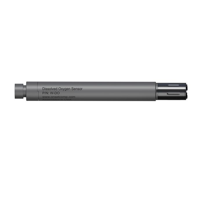
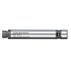
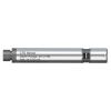
HOBO Dissolved Oxygen Sensor
The dissolved oxygen sensor is an interchangeable sensor that works with HOBO MX800 Series Water Loggers to measure dissolved oxygen (DO) and temperature.
Features
- User-replaceable DO cap lasts 2 years or more
- High accuracy measurements, even without calibration
- Get salinity-adjusted DO directly when used with conductivity sensor (W-CT or W-CTD)
Your Price
$995.00
Stock
2
AVAILABLE
Fondriest Exclusives
- Free ground shipping
- Expedited repair and warranty service
- Lifetime technical support
- More
The dissolved oxygen sensor is an interchangeable sensor that works with HOBO MX800 Series Water Loggers to measure dissolved oxygen and temperature. The DO sensor can be attached directly to the fully submersible MX801 model, or attached via cable to the direct read MX802 model, which doesn’t require having to pull the sensor out of the water to download data.
When this sensor is connected to a HOBO MX800 logger that also has a conductivity or CTD sensor attached, the logger can record salinity-adjusted DO directly. With this sensor attached to the HOBO MX802 direct read model, the logger can calculate DO percent saturation directly. When used with fully submersible HOBO MX801 model, a barometric logger data file (from either an MX802 or MX2001 logger) is needed to calculate DO percent saturation, for post-processing in the HOBOconnect app. In waters with changing salinity, the logger must also have a salinity sensor attached or you will need an MX800 salinity data file to get DO percent saturation.
- User-replaceable DO cap lasts 2 years or more
- High accuracy measurements, even without calibration
- Get salinity-adjusted DO directly when used with conductivity sensor (W-CT or W-CTD), no need for post-processing
- Direct DO percent saturation data, no need for post-processing (when used with MX802)
- Easy calibration with included calibration boot – saves time
- 1” diameter for use in narrow wells (with cable to MX802 above the well)
- PVC housing holds up in saltwater
Dissolved Oxygen
Optical Sensor: Dynamic luminescence quenching)
Measurement Range: 0 to 60 mg/L; 0-600% Saturation
Accuracy Out-of-Box: ±0.2 mg/L over the range of 0 to 20 mg/L; ±4% over the range of 20 to 60 mg/L
Accuracy with User Calibration: ±0.1 mg/L over the range of 0 to 20 mg/L; ±2% over the range of 20 to 60 mg/L
Resolution: 0.01 mg/L
Sensor Drift: Accuracy is maintained for 2 years; aside from the effects of fouling
Response Time: To 90% in less than 45 sec
DO Sensor Cap Life: 2 years; after this the sensor will continue operate, but possibly with less accuracy
Temperature
Measurement Range: -5 to 50°C (23 to 104°F), non-freezing
Temperature Accuracy: 0.15°C (0.27°F)
Temperature Resolution: 0.01°C (0.04°F)
Response Time: To 90% in less than 15 minutes
Logging Rate: When using this sensor, the maximum logging rate is 1 min
Depth Rating: IP-68, waterproof to 100 m (328 ft) - must be attached to logger and have DO sensor cap installed
Wetted Materials: Black Delrin, PVC, EPDM o-rings, rated for saltwater use
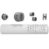
- (1) Dissolved oxygen sensor
- (1) Dissolved oxygen sensor cap
- (1) Calibration boot and sponge
Questions & Answers
Select Options
Products
0 Item Selected
Image
Part #
Description
Price
Stock
Quantity

W-DO
HOBO dissolved oxygen & temperature sensor
$995.00
2 Available
Accessories
0 Item Selected


Notice: At least 1 product is not available to purchase online
Related Products
In The News


