
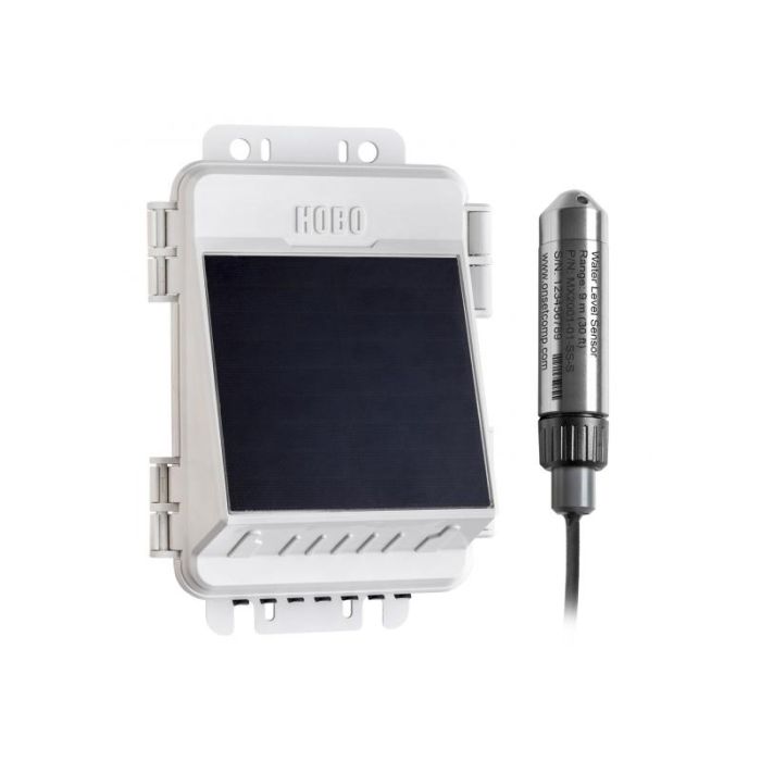
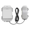
HOBO MicroRX Water Level Station
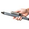
The Onset HOBO MicroRX Water Level Station is a cellular, web-enabled water level monitoring solution for stormwater, floodwater, irrigation, hydrologic, and environmental applications.
Features
- Eliminate complicated manual calculations with pre-programmed water flow formulas
- Act quickly in response to alarms triggered at time of measurement for water flow and accumulated rainfall
- Reduce maintenance visits with the non-vented water level sensor
Starting At
$830.00
Stock
1
AVAILABLE
Fondriest Exclusives
- Free ground shipping
- Expedited repair and warranty service
- Lifetime technical support
- More
Overview
The Onset HOBO MicroRX Water Level Station is a cellular, web-enabled water level monitoring solution for stormwater, floodwater, irrigation, hydrologic, and environmental applications. Pre-programmed water flow formulas for select weirs, flumes, and a stage discharge table result in an easy and intuitive configuration.
Mechanics
New water flow and accumulated rainfall calculations, which are performed directly on the station at time of measurement, trigger immediate notifications of critical water level conditions. The compact and durable station, together with the non-vented water level sensor, enables harsh condition deployments and reliable monitoring. The optional integrated solar panel or battery power, with a wide range of plug-and-play smart sensors, supports flexible environmental monitoring.
Benefits
- Station-side alarms for water flow and accumulated rainfall triggered at time of measurement
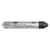
- Non-vented ceramic water level sensor with a choice of four ranges
- Interchangeable, Kevlar-reinforced water level sensor cables
- Integrated barometric pressure sensor
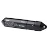
- Compact IP66/NEMA 4X enclosure
- Built-in LCD confirms proper setup and operation
- Two power options:
- Integrated 1.7 W solar panel with rechargeable battery pack
- 5 W and 15 W external solar panels can be added (RX2104 only)
- User-replaceable AA lithium batteries
- Inputs for five plug-and-play sensors
- Up to 10-minute connections rates via 4G cellular data plans
- Cloud-based monitoring and data access through HOBOlink
- Available with stainless steel or titanium sensor ends
- 3-point NIST-traceable calibration certificate included for the water pressure sensor
Questions & Answers
Select Options
Products
0 Item Selected
Image
Part #
Description
Price
Stock
Quantity

RX2103
HOBO MicroRX water level station, battery (cable/sensor sold separately)
$830.00
Check Availability

RX2104
HOBO MicroRX water level station, solar (cable/sensor sold separately)
$899.00
1 Available
Accessories
0 Item Selected


Notice: At least 1 product is not available to purchase online
Related Products
In The News


