
Spectrum WatchDog 3250 Wireless ET Stations
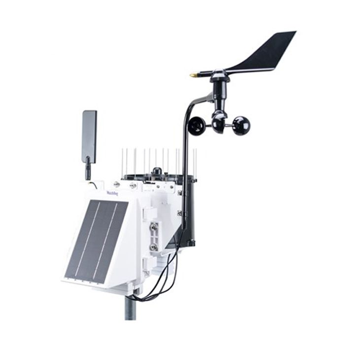
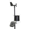
The Spectrum WatchDog 3250 wireless ET weather station calculates evapotranspiration and includes wind speed/direction, temperature, dew point, RH, rainfall, and solar radiation sensors.
Features
- Integrated solar power system for reliable power
- Optional Wi-Fi or cellular modem for wireless communications
- Integrated data logger holds 18 months of data at a 15-minute recording interval
Starting At
$2,075.00
Stock
1
AVAILABLE
Fondriest Exclusives
- Free ground shipping
- Expedited repair and warranty service
- Lifetime technical support
- More
Overview
The fully integrated WatchDog 3250 Wireless ET Station measures temperature, humidity, rainfall, and wind speed & direction, recording and communicating the data to the cloud using its internal modem or radio. With these sensors, evapotranspiration (ET) can be computed by SpecConnect, and users can know how much water is leaving the fields.
Benefits
- Integrated Solar Power system for reliable power
- Integrated Modem/Radio for reliable communications: available with a choice of cellular modems or other radios.
- Integrated Data Logger protects your data. Holds over 18 months of data at a 15-minute recording interval. Data can be transferred to a USB flash drive.
- Easy to install - be running in minutes. Mounts to a 1.25 inch mast. U-bolts included.
- Bluetooth connectivity to your Apple or Android smartphone running the free WatchDog Mobile App speeds setup and displays current conditions.
- Sends data to the SpecConnect Cloud Solution - View current conditions or historical data using a broad selection of analytical reports from anywhere in the world.
- Receive alerts via automated phone call, text message, and/or email immediately when temperature crosses your selected threshold - no waiting for the next scheduled upload.
- Customizable with plug-in sensors to meet your needs
- Receive the latest changes with over-the-air updates (also available via a USB flash drive).
- Durable enclosure provides moisture, corrosion, and UV protection for increased reliability in harsh environments.
- Designed and manufactured in the USA to provide the quality data you can rely on.
- External Communication: Cellular, USB, Bluetooth, RS232
- External Sensor Ports: 1 x 2.5mm stereo jack (0 to 3.0VDC analog input)
- Data Capacity: 30,000 data intervals can be stored on the unit before the oldest record is overwritten by the newest data (312 days at 15 minute intervals).
- Dimensions (HxLxW): 12 x 19.5 x 11.25 in (30.5 x 49.5 x 28.6 cm). (Without 7.25 in (18.4 cm) antenna)
- Weight: 9.9 lbs. (4.5 kg)
- Power Source: 3.5W solar panel, Rechargeable 6V/4.5AH SLA battery, optional AC/DC power adapter.
- Battery Life: 14 days minimum with no solar power.
- LED: 3-color (Red, Amber, Green)
- Operating Temperature Range: -22° to 130°F (-30° to 55°C)
Questions & Answers
Select Options
Products
0 Item Selected
Image
Part #
Description
Price
Stock
Quantity

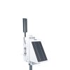
3250DR
WatchDog 3250 wireless ET station, no modem
$2,075.00
1 Available

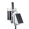
3250WF
WatchDog 3250 wireless ET station, Wi-Fi modem
$2,285.00
Check Availability

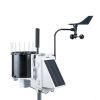
3250MU
WatchDog 3250 wireless ET station, LTE-M modem
$2,395.00
Check Availability

3250C4
WatchDog 3250 wireless ET station, LTE CAT-4 modem
$2,545.00
Check Availability
Accessories
0 Item Selected


Notice: At least 1 product is not available to purchase online
Related Products
In The News


