
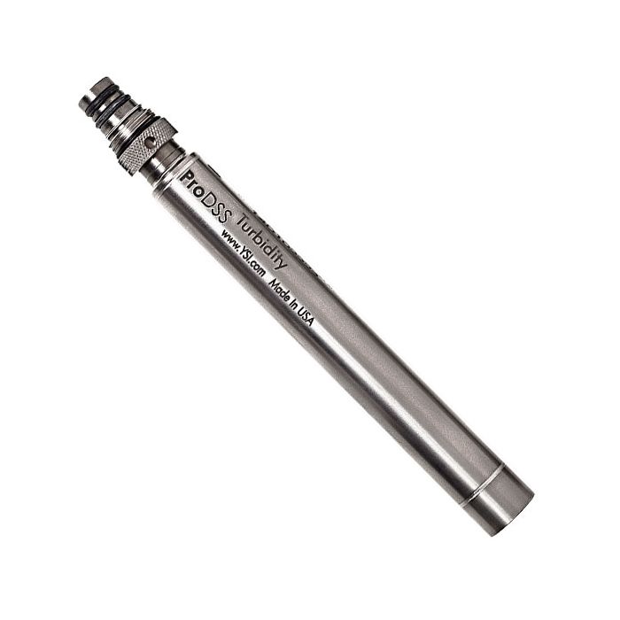
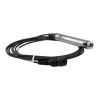
YSI ProDSS Turbidity Sensor
The YSI ProDSS turbidity sensor is a digital smart sensor featuring welded titanium construction for use with the ProDIGITAL family of instruments.
Features
- 0 to 4000 FNU measurement range
- T63<2 sec response time
- 0.3 FNU or ±2% of reading accuracy from 0 to 999 FNU
Your Price
$1,243.55
Stock
4
AVAILABLE
Fondriest Exclusives
- Free ground shipping
- Expedited repair and warranty service
- Lifetime technical support
- More
Overview
The ProDSS turbidity sensor is a digital smart sensor featuring welded titanium construction for use with the ProDIGITAL family of instruments. Compatible instruments include the ProDSS Meter, ProSwap Meter, and ProSwap Logger.
Mechanics
Turbidity is the indirect measurement of the suspended solid concentration in water and is typically determined by shining a light beam into the sample solution and then measuring the light that is scattered off of the particles which are present. The suspended solid concentration is an important water quality factor and is a fundamental measure of environmental change. The source of the suspended solids varies in nature (examples include silt, clay, sand, algae and organic matter), but all particles will impact the light transmittance and result in a turbidity signal.
Customizable
The ProDSS Turbidity sensor employs a near-infrared light source and detects scattering at 90 degrees of the incident light beam. According to ASTM D7315 method, this type of turbidity sensor has been characterized as a nephelometric near-IR turbidimeter, non-ratiometric. This method calls for this sensor type to report values in formazin nephelometric units (FNU). FNU is the default calibration unit for the ProDSS sensor, but users are able to change calibration units to nephelometric turbidity units (NTU), raw sensor signal (RAW), or total suspended solids (TSS).
ProDSS Smart Sensor Specifications:
| Parameter |
Range | Accuracy* | Resolution |
|---|---|---|---|
|
Conductivity |
0 to 200 mS/cm |
From 100 to 200 mS/cm: ± 1% |
**0.001, 0.01 or 0.1 µS/cm |
|
Temperature |
-5 to 70 °C |
± 0.2 °C |
0.1 °C or 0.1 °F |
| Dissolved Oxygen |
0 to 50 mg/L |
From 0 to 20 mg/L: ± 1% From 20 to 50 mg/L: ± 8% |
0.01 mg/L or 0.1 mg/L |
| pH |
0 to 14 |
± 0.2 |
0.01 |
|
ORP |
-1999 to 1999 mV |
± 20 mV |
0.1 mV |
| Turbidity |
0 to 4000 FNU |
From 0 to 999 FNU: ± 2% From 1000 to 4000 FNU: ± 5% |
0.1 FNU |
| Freshwater Total Algae |
0 to 100 µg/L PC |
r2 = 0.999 |
0.01 µg/L PC |
| Saltwater Total Algae |
0 to 280 µg/L PE |
r2 = 0.999 |
0.01 µg/L PE |
| Nitrate |
0 to 200 mg/L |
± 10% |
0.01 mg/L |
| Ammonium |
0 to 200 mg/L |
± 10% |
0.01 mg/L |
| Chloride |
0 to 1000 mg/L Cl |
± 15% |
0.01 mg/L |
*Reference specification for each sensor for more details on accuracy
** Range dependent
Questions & Answers
Select Options
Products
0 Item Selected
Image
Part #
Description
Price
Stock
Quantity

626901
ProDSS turbidity sensor
$1,243.55
4 Available
Accessories
0 Item Selected


Notice: At least 1 product is not available to purchase online
Related Products
In The News


