
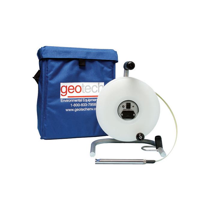
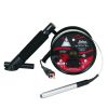
Geotech Oil/Water Interface Meters
The Geotech Interface Meter can be used in numerous applications including measuring oil and water levels in monitoring wells and detecting tank leakage.
Features
- Extremely durable polypropylene storage reel with rugged aluminum frame
- Highly accurate Kynar coated steel tape marked in engineering or metric units
- Field replaceable probe is only 5/8" in diameter
Starting At
$1,550.00
Stock
Drop Ships From
Manufacturer
Fondriest Exclusives
- Free ground shipping
- Expedited repair and warranty service
- Lifetime technical support
- More
Overview
The Geotech Interface Meter can be used in numerous applications including measuring oil and water levels in monitoring wells, detecting tank leakage and obtaining accurate measurements of water levels. When the Geotech Interface Meter is lowered down a well and contacts the product layer, a solid tone and green light alarm is activated on the reel. When the probe detects water, the tone begins to oscillate and the light changes to green.
Benefits
- Extremely durable polypropylene storage reel with rugged aluminum frame
- Highly accurate Kynar coated steel tape marked in engineering or metric units
- Field replaceable probe is only 5/8"" in diameter
- Stainless Steel conductors for durability
- FEP and stainless steel probe with Viton strain relief
- Audible and visible alarms activated on reel when probe contacts product and water
- Auto shut-off circuit to extend battery life
- Easily replaced 9 volt battery
- Water-resistant padded carrying case to protect instrument
- Built-in reel hanger for longer tape life
- (1) Interface meter
- (1) Carrying case
- (1) Operations manual
Questions & Answers
Select Options
Products
0 Item Selected
Image
Part #
Description
Price
Stock
Quantity

82050042
Oil/water interface meter with imperial increments, 100'
$1,550.00
Drop Ships From
Manufacturer

82050045
Oil/water interface meter with metric increments, 30m
$1,550.00
Drop Ships From
Manufacturer

82050043
Oil/water interface meter with imperial increments, 200'
$1,750.00
Drop Ships From
Manufacturer

82050046
Oil/water interface meter with metric increments, 60m
$1,750.00
Drop Ships From
Manufacturer

82050044
Oil/water interface meter with imperial increments, 300'
$1,950.00
Drop Ships From
Manufacturer

82050047
Oil/water interface meter with metric increments, 100m
$1,950.00
Drop Ships From
Manufacturer

82050006
Oil/water interface meter with imperial increments, 500'
$2,550.00
Drop Ships From
Manufacturer

82050007
Oil/water interface meter with imperial increments, 750'
$2,900.00
Drop Ships From
Manufacturer

82050008
Oil/water interface meter with imperial increments, 1000'
$3,300.00
Drop Ships From
Manufacturer
Notice: At least 1 product is not available to purchase online
Related Products
In The News


