
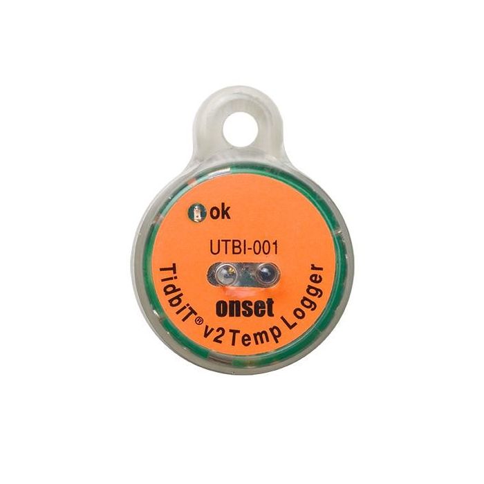
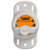
HOBO TidbiT v2 Temperature Logger
The HOBO TidbiT v2 Temperature Logger measures temperatures over a wide temperature range in outdoor and underwater environments.
Features
- HOBO's smallest temperature data logger (3x4 cm)
- Waterproof to 300 meters (1,000 feet)
- Data readout in less than 30 seconds via fast Optic USB interface
Your Price
$189.00
Stock
Check
Availability
Fondriest Exclusives
- Expedited repair and warranty service
- Lifetime technical support
- More
Overview
The HOBO TidbiT v2 Temperature Logger measures temperatures over a wide temperature range in outdoor and underwater environments. The TidbiT v2 provides 12-bit resolution and has ±0.2 °C accuracy. It is designed for outdoor and underwater environments and is waterproof to 300m (1000 ft). An optical USB interface allows users to offload data in seconds.
*Please note: A solar radiation shield is required to obtain accurate air temperature measurements in sunlight (RS1 Solar Radiation Shield, assembly required; or M-RSA pre-assembled Solar Radiation Shield).
Temperature Sensor
Operation range:* -20° to 70°C (-4° to 158°F) in air; maximum sustained temperature of 30°C (86°F) in water*
Accuracy: ±0.21°C from 0° to 50°C (±0.38°F from 32° to 122°F)
Resolution: 0.02°C at 25°C (0.04°F at 77°F)
Response time: 5 minutes in water; 12 minutes in air moving 2 m/sec; 20 minutes in air moving 1 m/sec (typical to 90%)
Stability (drift): 0.1°C (0.18°F) per year
Logger
Real-time clock: ± 1 minute per month 0° to 50°C (32° to 122°F)
Battery: 3 Volt lithium, non-replaceable
Battery life (typical use): 5 years with 1 minute or greater logging interval
Memory (non-volatile): 64K bytes memory (approx. 42,000 12-bit temperature measurements)
Weight: 19.6 g (0.69 oz)
Dimensions: 3.0 × 4.1 × 1.7 cm (1.2 × 1.6 × 0.68 in.); mounting bail 4.6 mm (3/16 in.) diameter hole
Wetted materials: Epoxy case
Waterproof: To 305 m (1000 ft.)
Logging interval: Fixed-rate or multiple logging intervals, with up to 8 user-defined logging intervals and durations; logging intervals from 1 second to 18 hours. Refer to HOBOware software manual.
Launch modes: Immediate start, delayed start
Offload modes: Offload while logging; stop and offload
Battery indication: Battery level can be viewed in status screen and optionally logged in datafile. Low battery indication in datafile.
Environmental Rating: IP68
NIST certificate: Available for additional charge
* To guarantee accuracy, the TidbiT v2 Temp must not be used in condensing environments and water temperatures higher than 30C (86F) for more than eight cumulative weeks over the life of the logger. Frequent or prolonged exposure will lead to measurement drift and eventual failure.
Questions & Answers
Select Options
Products
0 Item Selected
Image
Part #
Description
Price
Stock
Quantity

UTBI-001
HOBO TidbiT v2 temperature logger
$189.00
Check Availability
Accessories
0 Item Selected


Notice: At least 1 product is not available to purchase online
Related Products
In The News


