
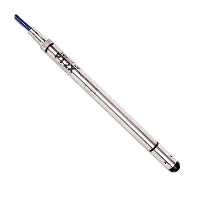
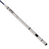
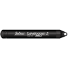
Seametrics PT2X Water Level Loggers
The Seametrics PT2X is ideal for observing flow patterns, testing pumps, and monitoring groundwater, well, tank and tidal levels.
Features
- Measures water level and temperature
- Internal data logger for 520,000 records
- Optional internal AA batteries operate for ~1 year at 15-minute log interval
Starting At
$1,664.00
Stock
1
AVAILABLE
Fondriest Exclusives
- Free ground shipping
- Expedited repair and warranty service
- Lifetime technical support
- More
Overview
The Seametrics PT2X is ideal for observing flow patterns, testing pumps, and monitoring groundwater, well, tank and tidal levels. A pressure and temperature sensor with integrated data logging, this sensor is constructed with 316 stainless steel, fluoropolymer, PTFE—providing highly accurate readings in rugged and corrosive field conditions.
Sensor
- Measures pressure, temperature, and time
- Available in absolute, gauge, or sealed gauge
- Thermally compensated
- ± 0.05% FSO typical accuracy
- Low power: 2 internal AA batteries
- External power options (12 VDC) with AA’s acting as backup
- 316 stainless steel, fluoropolymer, and PTFE construction (titanium optional)
- Available for both Modbus and SDI-12 protocols
Data Logger
- Non-volatile memory: Data will not be lost in the event of a power failure
- Flexible, multi-phase logging sequences: Measure at specified intervals and save instructions to disk for reuse
- Pause logging feature: Temporarily pause the logging while repositioning or transporting the sensor
- Delayed start feature: State a specific future start time, making it easy to set several sensors to start at the same time
Cabling & Networking
- Wireless connectivity
- RS485 network: Allows several sensors to be networked together and provides much longer cable leads
- Field-serviceable connectors: Easily remove the connector, route the cable through well seals, walls, or conduit, and then replace the connector
- Available cableless or with a variety of cable options, including polyethylene, polyurethane, and FEP
Software
- Comes with free Aqua4Plus control software to get up and running immediately
- View data in real-time
- Easy export to spreadsheets and databases
- Barometric compensation utility for use with absolute sensors
- Update sensor via firmware while in the field
Questions & Answers
Select Options
Products
0 Item Selected
Image
Part #
Description
Price
Stock
Quantity

2A31724
PT2X vented water level & temperature logger with stainless steel housing, 5 PSIG range, requires cable
$1,664.00
Check Availability

2A31726
PT2X vented water level & temperature logger with stainless steel housing, 15 PSIG range, requires cable
$1,664.00
Check Availability

2A31728
PT2X vented water level & temperature logger with stainless steel housing, 30 PSIG range, requires cable
$1,664.00
Check Availability

2A31730
PT2X vented water level & temperature logger with stainless steel housing, 50 PSIG range, requires cable
$1,664.00
Check Availability

2A31732
PT2X vented water level & temperature logger with stainless steel housing, 100 PSIG range, requires cable
$1,664.00
Check Availability

2A31734
PT2X vented water level & temperature logger with stainless steel housing, 300 PSIG range, requires cable
$1,664.00
Check Availability

2A31752
PT2X non-vented water level & temperature logger with stainless steel housing, 30 PSIA range, requires cable
$1,664.00
Check Availability

2A31754
PT2X non-vented water level & temperature logger with stainless steel housing, 50 PSIA range, requires cable
$1,664.00
Check Availability

2A31756
PT2X non-vented water level & temperature logger with stainless steel housing, 100 PSIA range, requires cable
$1,664.00
Check Availability

2A31758
PT2X non-vented water level & temperature logger with stainless steel housing, 300 PSIA range, requires cable
$1,664.00
Check Availability

2A32724
PT2X vented water level & temperature logger with titanium housing, 5 PSIG range, requires cable
$2,125.00
Check Availability

2A32726
PT2X vented water level & temperature logger with titanium housing, 15 PSIG range, requires cable
$2,125.00
Check Availability

2A32728
PT2X vented water level & temperature logger with titanium housing, 30 PSIG range, requires cable
$2,125.00
Check Availability

2A32730
PT2X vented water level & temperature logger with titanium housing, 50 PSIG range, requires cable
$2,125.00
Check Availability

2A32732
PT2X vented water level & temperature logger with titanium housing, 100 PSIG range, requires cable
$2,125.00
Check Availability

2A32734
PT2X vented water level & temperature logger with titanium housing, 300 PSIG range, requires cable
$2,125.00
Check Availability

2A32752
PT2X non-vented water level & temperature logger with titanium housing, 30 PSIA range, requires cable
$2,125.00
Check Availability

2A32754
PT2X non-vented water level & temperature logger with titanium housing, 50 PSIA range, requires cable
$2,125.00
Check Availability

2A32756
PT2X non-vented water level & temperature logger with titanium housing, 100 PSIA range, requires cable
$2,125.00
Check Availability

2A32758
PT2X non-vented water level & temperature logger with titanium housing, 300 PSIA range, requires cable
$2,125.00
Check Availability

2A41720
PT2X vented water level & temperature logger with stainless steel housing, 1 PSIG range, requires cable & external power
$1,632.00
Check Availability

2A41724
PT2X vented water level & temperature logger with stainless steel housing, 5 PSIG range, requires cable & external power
$1,484.00
Check Availability

2A41726
PT2X vented water level & temperature logger with stainless steel housing, 15 PSIG range, requires cable & external power
$1,484.00
1 Available

2A41728
PT2X vented water level & temperature logger with stainless steel housing, 30 PSIG range, requires cable & external power
$1,484.00
Check Availability

2A41730
PT2X vented water level & temperature logger with stainless steel housing, 50 PSIG range, requires cable & external power
$1,484.00
Check Availability

2A41732
PT2X vented water level & temperature logger with stainless steel housing, 100 PSIG range, requires cable & external power
$1,484.00
Check Availability

2A41734
PT2X vented water level & temperature logger with stainless steel housing, 300 PSIG range, requires cable & external power
$1,484.00
Check Availability

2A41752
PT2X non-vented water level & temperature logger with stainless steel housing, 30 PSIA range, requires cable & external power
$1,484.00
Check Availability

2A41754
PT2X non-vented water level & temperature logger with stainless steel housing, 50 PSIA range, requires cable & external power
$1,484.00
Check Availability

2A41756
PT2X non-vented water level & temperature logger with stainless steel housing, 100 PSIA range, requires cable & external power
$1,484.00
Check Availability

2A41758
PT2X non-vented water level & temperature logger with stainless steel housing, 300 PSIA range, requires cable & external power
$1,484.00
Check Availability

2A42724
PT2X vented water level & temperature logger with titanium housing, 5 PSIG range, requires cable & external power
$1,865.00
Check Availability

2A42725
PT2X vented water level & temperature logger with titanium housing, 15 PSIG range, requires cable & external power
$1,865.00
Check Availability

2A42728
PT2X vented water level & temperature logger with titanium housing, 30 PSIG range, requires cable & external power
$1,865.00
Check Availability

2A42730
PT2X vented water level & temperature logger with titanium housing, 50 PSIG range, requires cable & external power
$1,865.00
Check Availability

2A42732
PT2X vented water level & temperature logger with titanium housing, 100 PSIG range, requires cable & external power
$1,865.00
Check Availability

2A42734
PT2X vented water level & temperature logger with titanium housing, 300 PSIG range, requires cable & external power
$1,865.00
Check Availability

2A42752
PT2X non-vented water level & temperature logger with titanium housing, 30 PSIA range, requires cable & external power
$1,865.00
Check Availability

2A42754
PT2X non-vented water level & temperature logger with titanium housing, 50 PSIA range, requires cable & external power
$1,865.00
Check Availability

2A42756
PT2X non-vented water level & temperature logger with titanium housing, 100 PSIA range, requires cable & external power
$1,865.00
Check Availability

2A42758
PT2X non-vented water level & temperature logger with titanium housing, 300 PSIA range, requires cable & external power
$1,865.00
Check Availability
Accessories
0 Item Selected


Notice: At least 1 product is not available to purchase online
Related Products
In The News


