
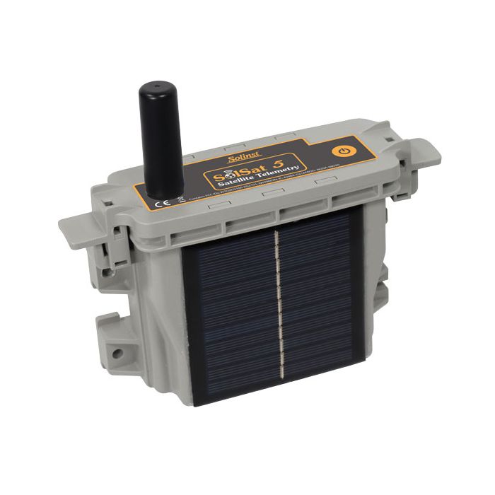
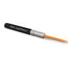
Solinst SolSat 5 Satellite Telemetry System
SolSat 5 is an advanced telemetry system that leverages Iridium satellite technology to provide global connectivity for remote water monitoring projects.
Features
- Global connectivity with Iridium satellite technology
- Compact and weatherproof housing for deployment in any environment
- Reports barometrically compensated water level data
Your Price
$1,825.00
Stock
Check
Availability
Fondriest Exclusives
- Free ground shipping
- Expedited repair and warranty service
- Lifetime technical support
- More
SolSat 5 Satellite Telemetry is an advanced telemetry system that leverages Iridium satellite technology to provide global connectivity for remote water monitoring projects. The SolSat 5 is simple to set up with Solinst dataloggers using an integral, secure Wi-Fi App on your smartphone.
SolSat 5 combines intelligent electronics with built-in sensors, alarm capabilities, and storage for up to 100,000 readings, allowing efficient satellite transmissions and power usage while providing high data integrity.
The SolSat 5 is compact, lightweight, and features a robust weatherproof enclosure. SolSat 5 is deployed anywhere with very little site preparation, saving costs and time in the field. A built-in solar panel extends the battery life, and you can easily add a second panel.
SolSat 5 Satellite Telemetry connects to one Solinst datalogger. The built-in barometric sensor allows for automatically compensated water level data reported from the field. Along with water level, temperature, conductivity, and barometric data, battery voltage from the remote SolSat 5 is received with each data report.
- Communication: 9603 Iridium SBD Satellite Modem
- Communication Distance: Global coverage (*clear view to the sky required for best performance and battery life)
- Antenna: High-performance helical (SMA connector)
- Data File Type: Sent via SMS, export as .csv or .xle
- Sampling Interval: Hourly
- Reporting Interval: Daily, every 6 hours, or hourly
- Schedule Programming: Wi-Fi App (browser) on your smart device or laptop
- Power Supply: 2 x 3.4 Ah LiPo batteries
- Battery Charging: USB 5 volts, built-in 2 Watt 325 mAh solar panel, optional additional solar panel
- Battery Life Estimate: 2–3 years* (based on hourly samples and one satellite transmission per day)
- Memory Capacity: 100,000 readings (wrap-around memory)
- Operating Temperature: -20ºC to +55ºC
- Weight: 535 grams (18.9 ounces)
- Size: 19.1 cm x 16.4 cm x 6.4 cm (7.5" x 6.5" x 2.5")
- IP Rating: IP66
- Compatible Dataloggers: Levelogger 5, Barologger 5, Levelogger 5 Junior, Levelogger 5 LTC, LevelVent 5
- Connected Dataloggers: 1
- Barometric Compensation: Internal barometer for automatic barometric compensation of water level data if a Barologger is not being used (not required for vented loggers)
- Internal Barometer Range: 30 kPa – 110 kPa
- Internal Barometer Accuracy: ±0.1 kPa (1 cm)
- Warranty: 1 Year
Questions & Answers
Select Options
Products
0 Item Selected
Image
Part #
Description
Price
Stock
Quantity

116895
SolSat 5 satellite telemetry system, Iridium
$1,825.00
Check Availability
Accessories
0 Item Selected


Notice: At least 1 product is not available to purchase online
Related Products

In The News


