
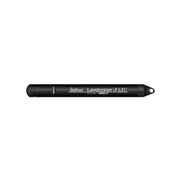
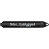
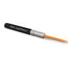
Solinst Levelogger 5 LTC Water Level & Conductivity Loggers
The Solinst Levelogger 5 LTC logs water level, temperature, and conductivity in a compact package with up to 8-year battery life and 3-year warranty.
Features
- Increased memory for logging up to 100,000 sets of data
- Upgraded platinum RTD and conductivity sensor for better sensitivity
- Double O-ring seals with 2x over pressurization rating
Starting At
$1,697.65
Stock
SEE TABLE BELOW
Fondriest Exclusives
- Free ground shipping
- Expedited repair and warranty service
- Lifetime technical support
- More
Overview
The Solinst Levelogger 5 LTC combines a datalogger, 8-year battery, Hastelloy pressure sensor, temperature detector, and conductivity sensor within a small waterproof housing, 22mm x 208mm (7/8" x 8.2"). A baked-on coating using polymerization technology protects the body against corrosion, abrasion and high temperatures. The conductivity sensor is a 4-electrode platinum sensor with autoranging capabilities. The minimal-maintenance, sealed Levelogger 5 LTC is simple to clean and calibrate, even in the field.
Level Sensor: Piezoresistive Silicon with Hastelloy Sensor
Ranges: 5, 10, 20, 30, 100, and 200 m
Accuracy: ±0.05% FS
Resolution: 0.001% FS to 0.0006% FS
Units of Measure: cm, m, ft, psi, kPa, bar (ºC, ºF)
Normalization: Automatic Temperature Compensation
Temp Comp. Range: 0ºC to 50ºC
Temperature Sensor: Platinum Resistance Temperature Detector (RTD)
Accuracy: ±0.05ºC
Resolution: 0.003ºC
Conductivity Sensor: 4-Electrode Platinum
Full Range: 0 – 100,000 µS/cm
Calibrated Range: 50 – 80,000 µS/cm
Accuracy: ±1%: 5,000 µS/cm – 80,000 µS/cm; greater of ±2% or 15 µS/cm: 50 µS/cm –5,000 µS/cm
Resolution: ±0.1 µS/cm
Temp Comp. Range: 0ºC – 50ºC
Normalization: Specific Conductance @ 25˚C
Battery Life: 8 Years (1 reading every 5 minutes)
Clock Accuracy (typical): ±1 minute/year (-20ºC to 80ºC)
Operating Temperature: -20ºC to 80ºC
Maximum Readings: 100,000 sets of readings
Memory: Slate or Continuous
Communication: Optical high-speed: 57,600 bps with USB
Size: 22 mm x 208 mm (7/8" x 8.2")
Weight: 197 grams (6.95 oz)
Corrosion Resistance: Baked-on coating using polymerization
Wetted Materials: Platinum, Delrin®, Viton®, 316L Stainless Steel, Hastelloy, Regulator approved PFAS-free PTFE
(inside and out)
Sampling Mode: Linear, Event & User-Selectable with Repeat Mode, Future Start, Future Stop, Real-Time View
Measurement Rates: 2 seconds to 99 hours
Barometric Compensation: Software Wizard and Barologger 5
Questions & Answers
Select Options
Products
0 Item Selected
Image
Part #
Description
Price
Stock
Quantity

114615
Levelogger 5 LTC water level, conductivity & temperature logger, 5m range
$1,697.65
3 Available

114616
Levelogger 5 LTC water level, conductivity & temperature logger, 10m range
$1,697.65
2 Available

114617
Levelogger 5 LTC water level, conductivity & temperature logger, 20m range
$1,697.65
1 Available

114618
Levelogger 5 LTC water level, conductivity & temperature logger, 30m range
$1,697.65
1 Available

114619
Levelogger 5 LTC water level, conductivity & temperature logger, 100m range
$1,697.65
1 Available

114620
Levelogger 5 LTC water level, conductivity & temperature logger, 200m range
$1,697.65
1 Available
Accessories
0 Item Selected


Notice: At least 1 product is not available to purchase online
Related Products
In The News


