
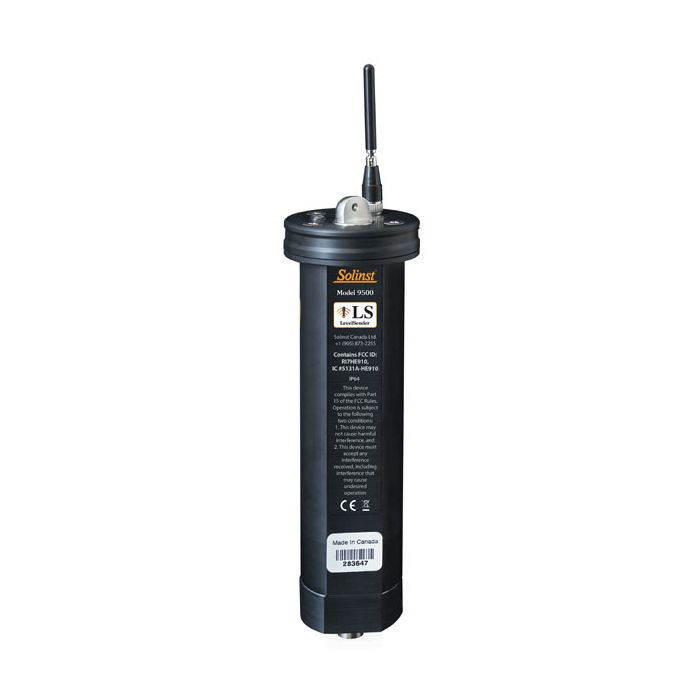
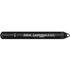
Solinst LevelSender 5 Cellular Telemetry System
The Solinst LevelSender 5 is a simple, low-cost system designed to wirelessly send data from Solinst dataloggers in the field, via cellular communication, to multiple emails and an SMS recipient.
Features
- Sized to fit inside a standard 2" well casing
- Remote data sent via email or SMS messaging
- Use database to import to a website or list
Starting At
$896.00
Stock
Check
Availability
Fondriest Exclusives
- Free ground shipping
- Expedited repair and warranty service
- Lifetime technical support
- More
Overview
The Solinst Level Sender 5 receives data on any chosen smart device. Solinst provides the option of a pre-programmed LevelSender with a 4G SIM APN setup. The Solinst SIM card scans multiple networks and connects to the strongest signal. Low-cost, data-only plans are billed directly through Solinst for convenience and can be purchased here https://solinstcloud.com/login/register.php
*Verizon SIM cards are not compatible
Compact Remote Stations
Can be discreetly installed inside a 2" diameter monitoring well or other housing. Each LevelSender 5 device has a single port to connect one datalogger. An optional splitter provides connections for two dataloggers, allowing the installation of a Levelogger and Barologger in the same well. Along with water level, temperature, conductivity, barometric, or rainfall data, battery level, and status updates from the remote LevelSender 5 are received with each data report.
Solinst Cloud
LevelSender telemetry system users can opt-in to the Solinst Cloud web-based data-management tool that enables the configuration and management of remote devices. Quickly view and assess remote projects, set alarms, download reports, and more using the online dashboard. Data plans start at no cost, with the option for expanding to low-cost plans for managing a larger network of Leveloggers.
LevelSender telemetry devices work with the LevelSender 5 using the following loggers:
- Solinst Levelogger 5 Series
- LevelVent 5
- Levelogger Edge Series
- LevelVent loggers
- Modem: 4G LTE UE Category M1/NB1 device (850/900/1800/1900 MHz)
- SIM Card: Standard SIM (15mm x 25mm); option of Solinst SIM or through service provider of client’s choice
- Communication: Email or SMS data transfer, Dynamic IP
- Antenna: SMA Male Monopole 2dBi
- Data File Type: text, .xle, .sqlite
- Sampling Interval: 1 minute - 99 hours
- Reporting Interval: 5 minutes - 99 hours
- Schedule Programming: Directly via USB-C connection on the LevelSender or remotely via LevelSender Software (email)
- Power Supply: 3 x AA 1.5V replaceable lithium batteries
- Battery Life Example: Hourly sampling and daily reporting: 4 years with 1 datalogger, 3.3 years with 2 dataloggers
- Operating Temperature: -20ºC to 60ºC
- IP Rating: IP67
- Materials: Black Delrin, 316 stainless steel
- Size: 2.5" x 9.375" (with antenna folded down)
- Weight: 16.9 oz. (478 grams)
- Compatible Dataloggers: Levelogger 5 Series dataloggers, LevelVent 5, AquaVent 5, as well as previous versions of the LevelVent and AquaVent, and Levelogger Edge Series dataloggers
- Number of Connected Leveloggers: 1, or 2 using a splitter
- Barometric Compensation: Internal barometer for automatic barometric compensation of water level data if a Barologger is not being used (not required for vented loggers)
- Internal Barometer Range: 30 kPa - 120 kPa
- Internal Barometer Accuracy: ±0.2 kPa (20 cm)
- (1) LevelSender
- (1) 2" Well Cap
- (1) Hanger Bracket
- (1) Set of Batteries
- (1) Antenna
Questions & Answers
Select Options
Products
0 Item Selected
Image
Part #
Description
Price
Stock
Quantity

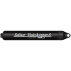
115604
LevelSender 5 cellular telemetry system, 4G LTE
$896.00
Check Availability

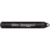
115924
LevelSender 5 cellular telemetry system, 4G LTE with active SIM (billed through Solinst)
$910.00
Check Availability
Accessories
0 Item Selected


Notice: At least 1 product is not available to purchase online
Related Products
In The News


